Skip to content
Drone Survey CompanyExeter · Devon and the South West

Exeter, Devon and the South West

Ask us the same questions you are asking the other two

Most drone firms look identical on a quote. What separates them is what is registered, what the insurance actually covers, who turns up on the day and what you are holding a week later. All of that is on this site.
  • One surveyor, named, who flies every job himself
  • Fixed price agreed before the visit, travel included
  • No scaffolding, no ladders, no roof access needed
  • Written report within 48 hours of the flight
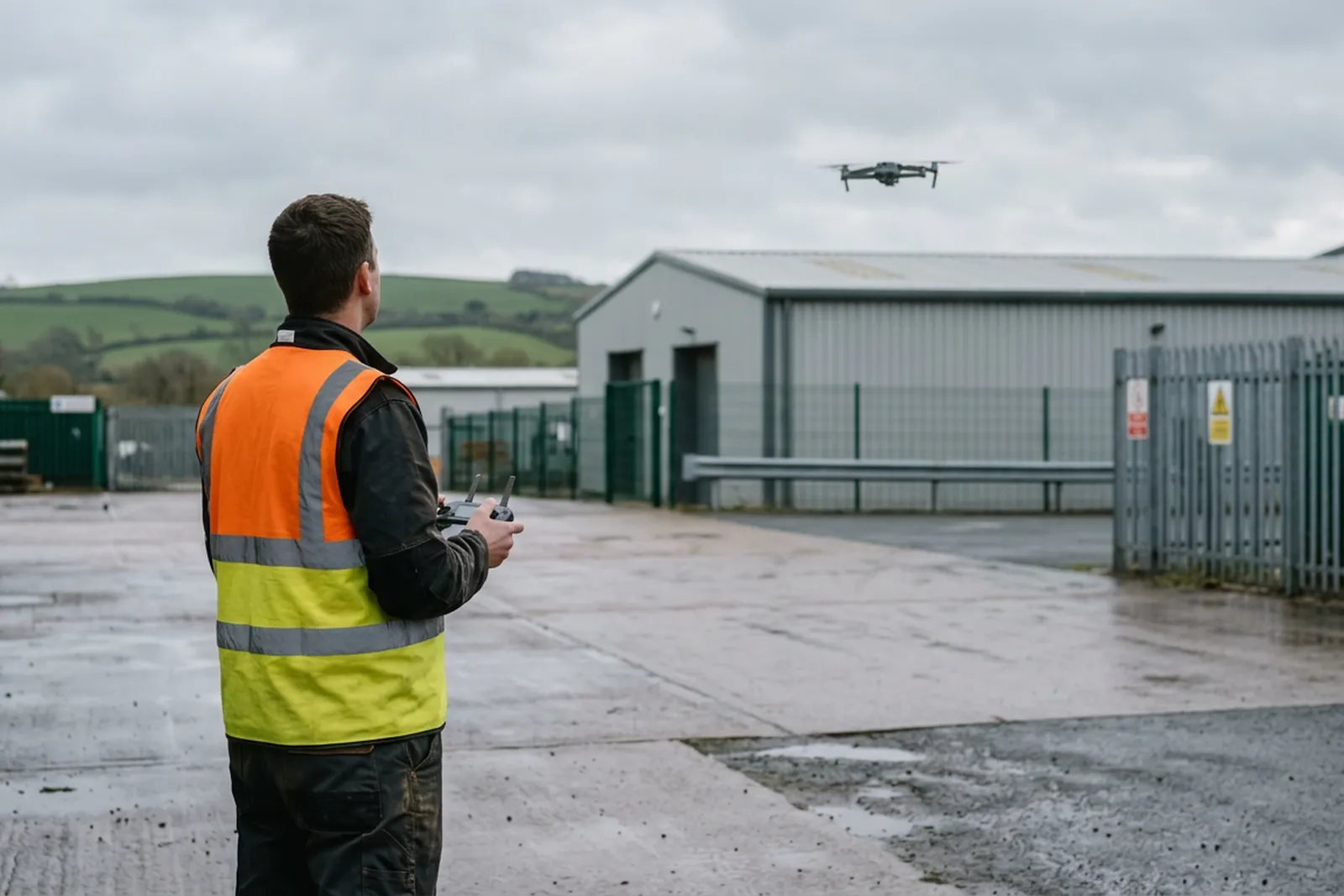
A drone pilot in a high visibility vest on a commercial yard in Devon, controller in both hands, watching a quadcopter hovering above the flat roof of an industrial unit
Operator
CAA registered
Certificate
A2 CofC
Insurance
Coverdrone
Aircraft
Mavic 4 Pro
Report
Within 48 hours

Choosing between quotes

Three quotes, three websites, and no way to tell them apart

Every drone firm's page says the same four things. Fully insured. CAA approved. Professional. Fast turnaround. None of it is checkable from the page you are reading, and by the time you find out which of the three was accurate, the job is already booked and someone is standing in your car park.

The things that actually differ are duller and harder to find. Whether the operator is registered and what certificate the pilot holds. What the insurance covers and whether a certificate will arrive before the visit or after it. Whether the person who quoted is the person who flies. What lands in your inbox afterwards, and whether anyone can read it without a phone call to explain it.

This site is those things, written out. Where something is a limit rather than a strength it says so, because a firm that only lists what it can do has left you to find the rest out yourself.

What gets flown

Three kinds of job, priced the same way

Commercial and managed buildings, houses and small blocks, and thermal work. Every one is a fixed price agreed before the visit with a written report inside 48 hours.
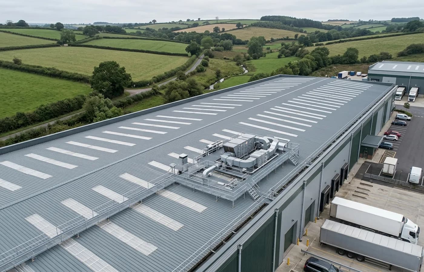
An industrial unit in Devon photographed from the air at an angle, showing the profiled metal roof, rooflights, parapet gutter and roof mounted plant

Commercial Drone Survey

Roofs, elevations, plant and hard to reach structures on commercial and managed buildings, with the paperwork a building manager needs on file.

Commercial survey
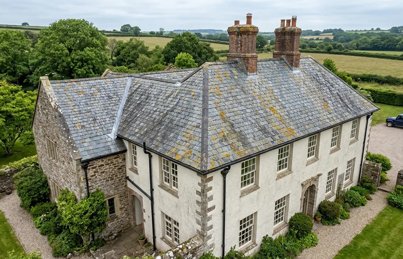
A Devon stone house with a steep natural slate roof photographed from the air, showing the ridge, two brick chimney stacks and a lead lined valley

Roof and Building Survey

Houses, small blocks and older buildings looked at properly from the air, with a report a roofer or a surveyor can work from.

Roof and building
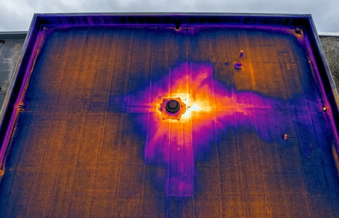
A radiometric thermal image of a flat commercial roof in ironbow false colour, showing a warm anomaly spreading beneath the membrane near an outlet

Thermal and Moisture Survey

Radiometric thermal imaging from the air, read against the conditions on the day, for heat loss, trapped moisture and hard to trace damp.

Thermal work

Credentials

What sits behind the survey

CAA registered

Registered with the Civil Aviation Authority as an operator, with an Operator ID and a Flyer ID held. Ask for the numbers and you will get them before the visit.

A2 Certificate of Competency

The pilot holds an A2 CofC, the certificate that allows flying closer to uninvolved people than the default. There is no GVC, and this site says so rather than leaving you to guess.

Insured with Coverdrone

Commercial operations are insured with Coverdrone. If your site or your managing agent needs a certificate on file, it goes over with the quote rather than after the flight.

Two aircraft, one pilot

A DJI Mavic 4 Pro with a 100 megapixel Hasselblad camera for detail, and a DJI Mavic 2 Enterprise Advanced with a 640 by 512 radiometric thermal camera. Sam Hembury flies both himself.

If you are holding three quotes

The questions that actually separate one drone firm from another

There is a page on this site that hands you the questions to put to every firm you are quoting, explains why each one matters, and answers each of them for us. It is the most useful page here if you have not decided yet.
  • What the certificate the pilot holds does and does not allow
  • Whether the insurance certificate arrives before the visit or after it
  • Whether the person who quoted is the person who flies
  • What is inside the fixed price and what gets added later

The deliverable

What you are holding two days later

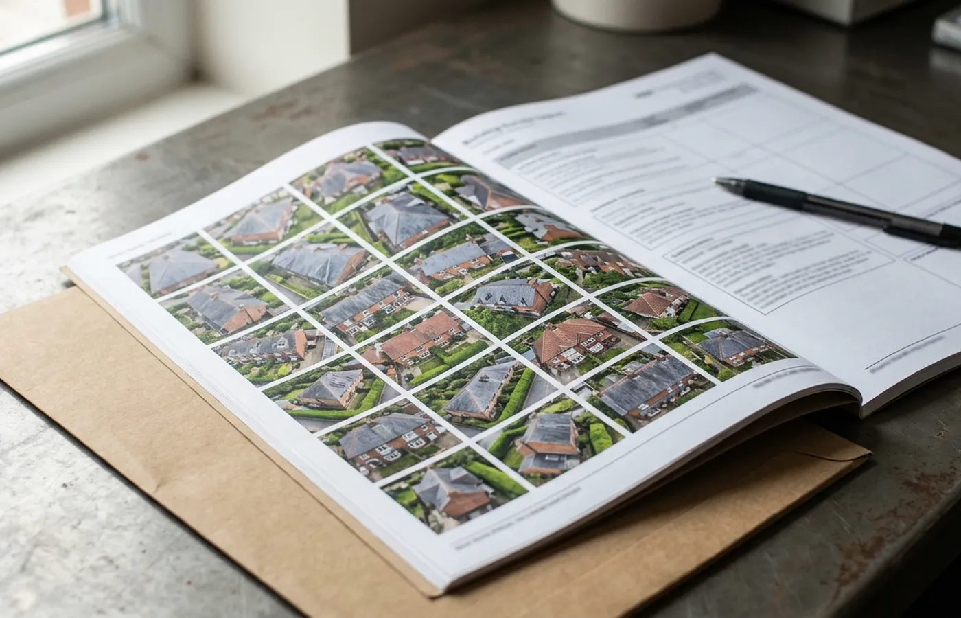
The report is the product. The flight is how the pictures get taken. This is what arrives, and it arrives in a form your roofer, your surveyor or your insurer can use without ringing us first.
  • A short summary that says what was looked at and what was found
  • Findings one by one, each with the photographs that show it
  • Full resolution imagery, yours to keep and pass on
  • Overview shots of every elevation and every roof slope
  • A plain note of anything that could not be seen on the day and why
  • Where something needs opening up or testing, a line saying so
A printed survey report open on a desk beside a laptop, showing a grid of aerial photographs of a roof

The work itself

What a survey looks like from both ends

The setup on the ground and the detail it produces. No stock photography and no borrowed imagery of somebody else's job.
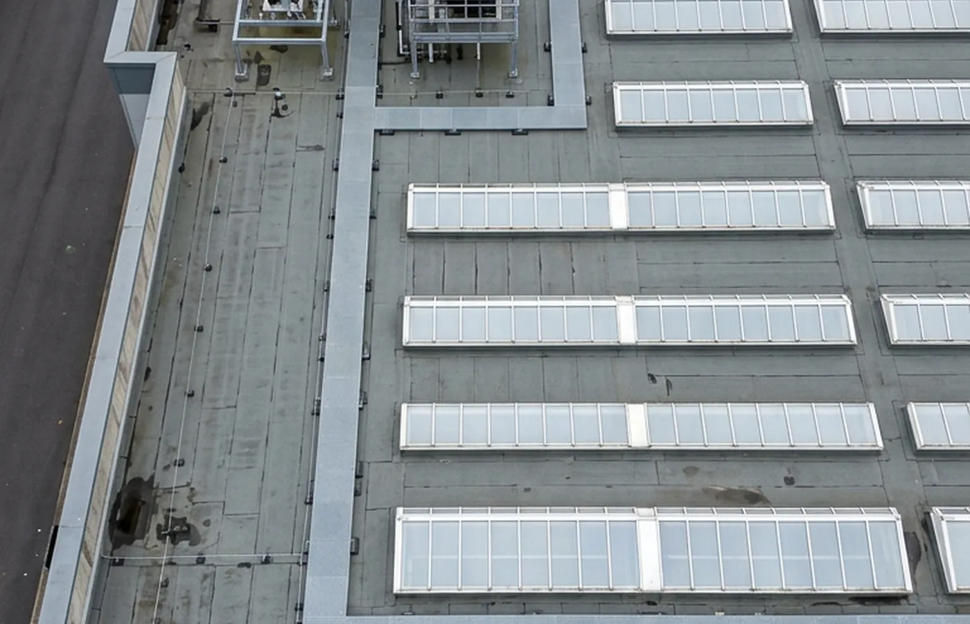
A flat commercial roof photographed straight down, showing rooflights, plant units and water standing around a blocked rainwater outlet
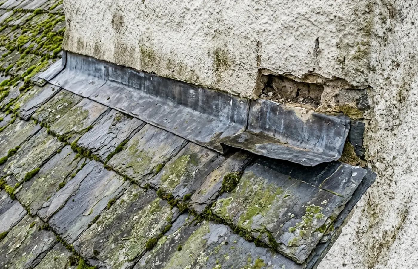
Close aerial detail of lead flashing lifting away from a rendered wall above a slate roof, with an open mortar joint above it
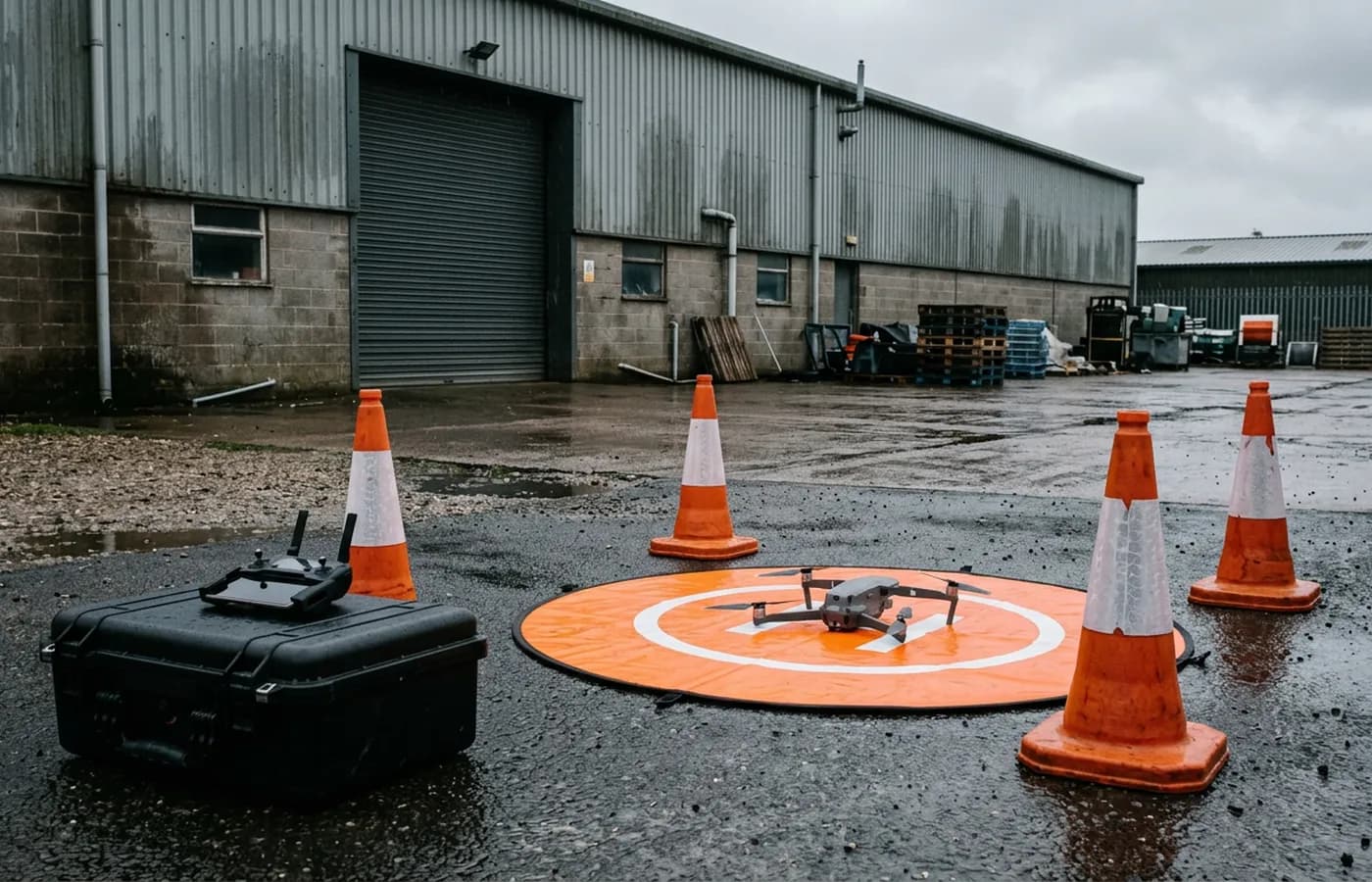
A drone take off area set up on a commercial yard, landing mat coned off on wet tarmac with the aircraft ready and the controller on a flight case
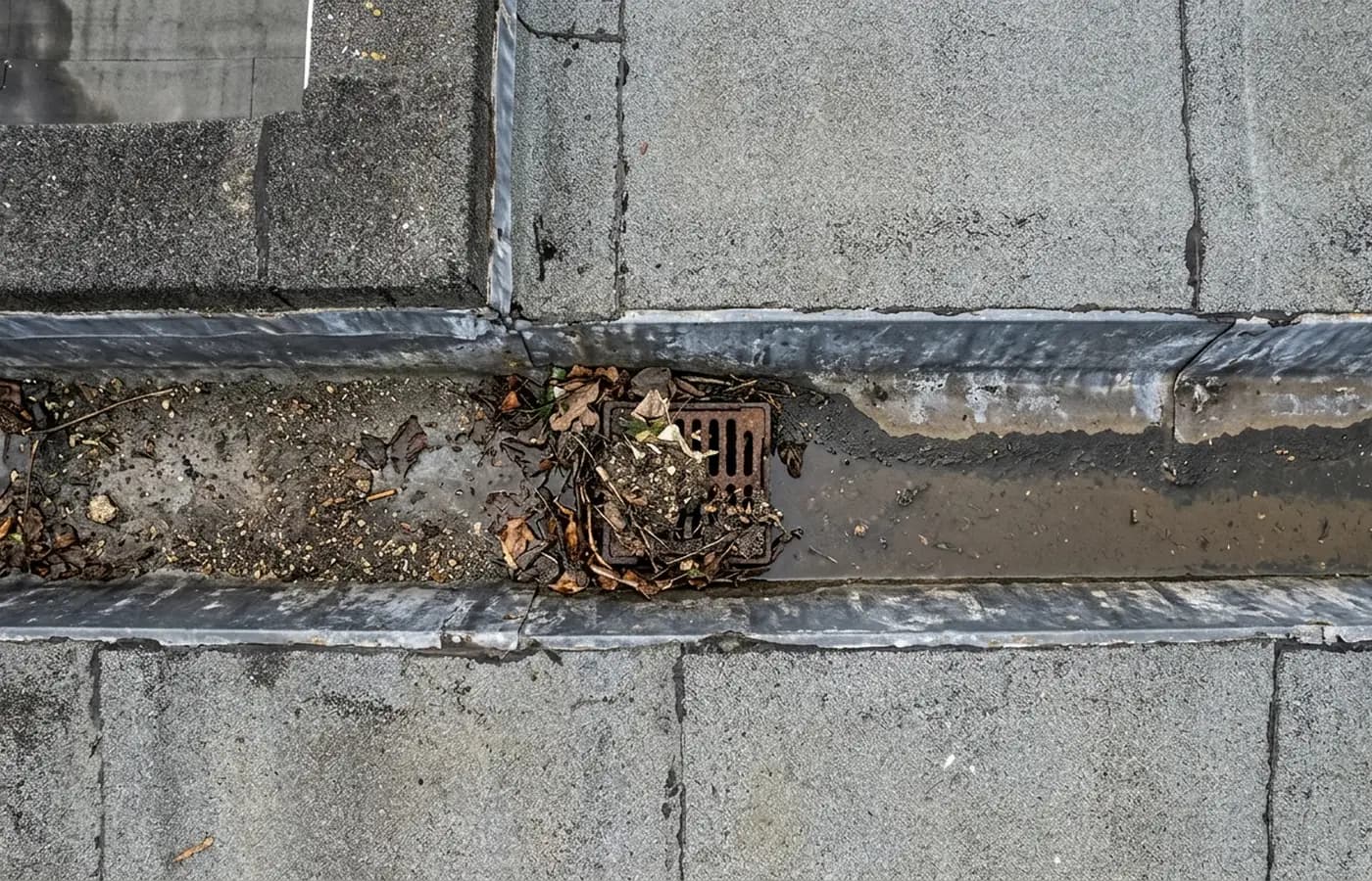
A parapet gutter on a commercial roof silted with grit and leaf litter, with a blocked outlet and a tide mark of standing water

Coverage

Where the van goes, and how long it takes to get there

Twenty five towns, grouped by the road out of Exeter rather than by county, each with a travel band instead of a promised arrival time.

Questions

Questions we get asked

Who actually turns up on the day?
Sam Hembury. There is no pool of subcontracted pilots and no franchise arrangement, so the person you speak to on the phone is the person standing in your yard with the controller. On a bigger commercial site he brings a second person to keep an eye on the ground while he flies.
What paperwork can you send before the visit?
The Coverdrone certificate, the Operator ID and Flyer ID numbers, and a site specific risk assessment and method statement where the building manager wants one. Ask at quote stage and it comes with the price rather than the week after.
You hold an A2 CofC and not a GVC. What does that rule out?
An A2 Certificate of Competency allows flying closer to uninvolved people than the default open category permission. It does not carry the wider operational authorisation a GVC leads to. In practice that means a job in a busy public space, or one that has to be flown very close to people and property outside your control, needs the area put under the client's control for the flight window or it does not get flown. If your site is that job, we will tell you at quote stage instead of on the day.
How is the price worked out?
A fixed price for the job, agreed in writing before the visit, with travel inside it. The address and a short description of what needs looking at is enough to price most work. If what is on site turns out to be materially different from what was described, the price is re-agreed before anything is flown.
How quickly do you get out to us?
It depends on your postcode and the weather, so this site gives travel bands from Exeter on each area page rather than a promised response time. Everything inside the ring of towns closest to Exeter is a short run out; the far end of Cornwall or Dorset is a planned day rather than a drop in. What we will do is give you a real date at quote stage instead of a vague soon.
What happens if the weather stops the flight?
It gets rescheduled at no cost. Wind, heavy rain, poor light and airspace restrictions all stop flights, and a rescheduled visit is normal rather than a failure. Nobody is charged for a flight that did not happen.
What do we actually receive at the end?
A written report inside 48 hours of the flight, with the photographs it is based on, laid out so the findings are in one place and the images that support each one sit with them. The imagery is yours to pass to a roofer, a surveyor, a solicitor or an insurer.
Do you work for managing agents and facilities teams?
Yes, and a good share of the work comes that way. Repeat visits on the same building can be booked as a set so the same views are captured each time and one year can be compared against the next.

See how a job runs

Request a quote with Drone Survey Company

Tell us the address and what you need looking at. Sam Hembury will come back with a fixed price and the next available slot.

Call 07576 579750Request a quote